History of the SARSAT program
Early Beginnings
These two satellite constellations – The U.S. Sarsat series, and the Russian Cospas series, began carrying SAR payloads in the early nineteen eighties and served as the backbone of the Cospas-Sarsat System from many years.
The beginnings of SARSAT date back to October 1972 when a plane carrying two U.S. congressmen, Rep. Hale Boggs (D-La.), the House majority leader and Rep. Nick Begich (D-Alaska), went missing in a remote region of Alaska. A massive search and rescue effort was mounted, but to this day, no trace of them or their aircraft has been found. In reaction to this tragedy, Congress mandated that all aircraft in the United States carry an Emergency Locator Transmitter (ELT). This device was designed to automatically activate after a crash and transmit a homing signal. ELT analog technology had been developed and available since the 1950s. It was designed to automatically transmit a homing signal when a military aircraft crashed.
The 121.5 MHz frequency selected for ELT transmissions was also already in use as the international aircraft distress frequency for voice transmissions. Even though this frequency was widely used, it had many limitations. The frequency was cluttered, there was no way to verify information concerning the signal other than location, and most importantly, another aircraft had to be within range to receive the signal.
The move to Satellites
As the sixties transitioned to the seventies, space shifted from being a new frontier to a platform for looking back at ourselves. Space technology applications opened up using satellites to address weather communications, and navigation. Within NASA it was recognized that another benefit of satellite technology could be search and rescue. It was thought that if overflying aircraft within limited range of a downed aircraft could pick up an activated beacon signal, imagine the coverage area if this same beacon could be picked up by an overflying satellite. And it would solve another problem…. it could also listen for and locate ships in distress at sea.
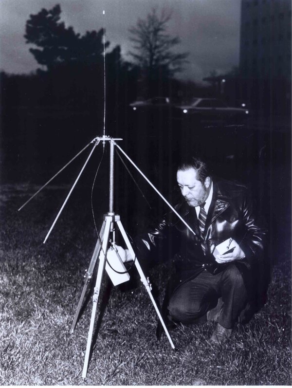
Photo courtesy of Katie Kirk
Bernie Trudell was assigned by NASA to explore the potential use of satellites for search and rescue. He and the scientists and engineers he led, saw their efforts realized when the Cospas-Sarsat agreement was signed in 1988.
These NASA engineers believed a satellite-based tracking system was the answer. They also believed that to reach its true potential, it would need a dedicated digital frequency reserved only for emergency beacons (digital 406 MHz), it would need a digital signal that uniquely identified each beacon. And the system detecting the signal would require dedicated global coverage, twenty-four hours a day, seven days a week.
Joint Partnership
The SARSAT system was developed in a joint effort by three countries that were all looking at space as a solution for improvements in search and rescue. The United States, Canada and France worked together to develop the space, ground and beacon technology needed for the system to work. In the United States, NASA took the lead. In the United States NOAA, NASA, the U.S. Coast Guard, and the USAF, partnered to form the U.S. SARSAT Program.
Once the system was functional, its operation was turned over to NOAA where it remains today. As the system began to take hold, more and more emergency beacons found their way onto the market. The U.S. Coast Guard in their role as maritime search and rescue specialists immediately saw the benefits of 406 MHz, and in 1990, took proactive steps to bring it into widespread usage. As a result, today there are over 723,000 emergency beacons registered in the NOAA 406 MHz Registration Database. Is your beacon part of that registered group?
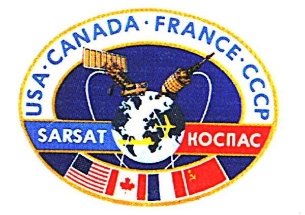
An early Soviet version of a now iconic Cospas-Sarsat crest. КОСПАС ( Cospas in English) is an acronym for the Russian words “Cosmicheskaya Sistyema Poiska Avariynich Sudov”, which means “Space System for the Search of Vessels in Distress.”
A similar system, COSPAS, was developed by the Soviet Union. The four nations, United States, Canada, France and the Soviet Union banded together in 1979 to form Cospas-Sarsat.
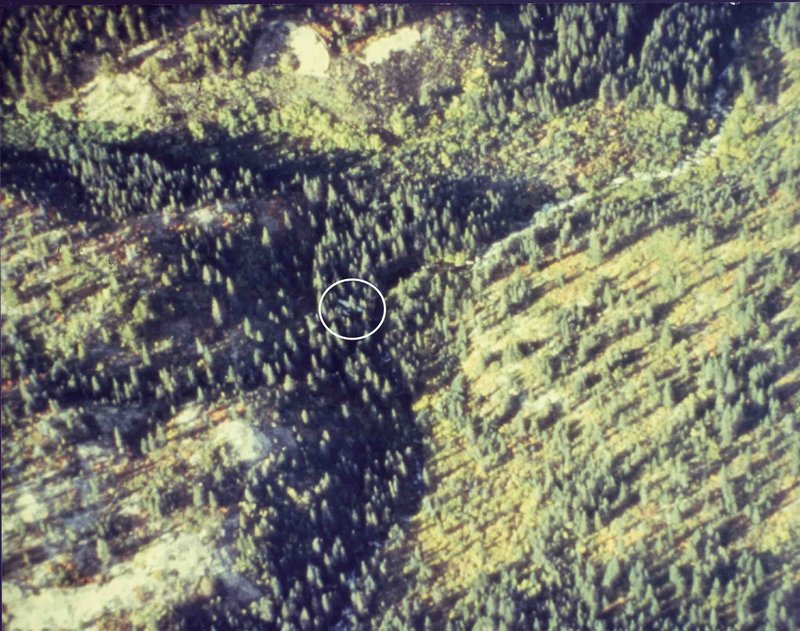
Photo courtesy of the Canadian Armed Forces
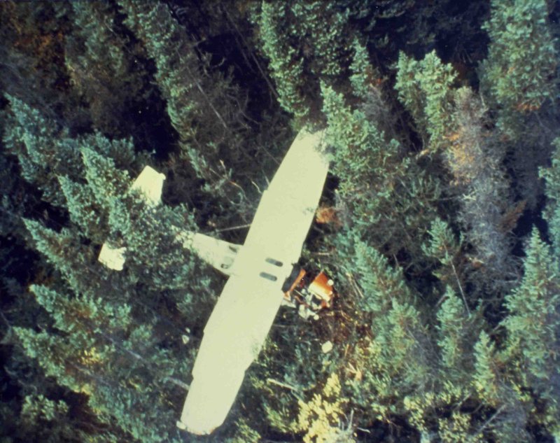
Photo courtesy of the Canadian Armed Forces
This is the scene of the first airplane crash found on September 10, 1982, using a satellite to detect a distress beacon. The first photo shows the altitude a plane typically flies at during a visual search. The barely visible plane is inside the white circle. The SAR crew who performed the rescue were amazed at the accuracy of the coordinates provided by the satellite and believe the plane would never have been found otherwise.
In 1982 satellites changed everything. On September 9th, only 40 days after the first satellite carrying a search and rescue (SAR) payload was launched and nine days after testing began, the first-ever distress signal was detected. An airplane had crashed in northern British Columbia, setting off its Emergency Locator Transmitter (ELT). The coordinates provided by the satellite allowed searchers to locate the airplane in a mountain valley the next day, over 50 miles off its planned route. All three survivors were rescued by Canadian SAR Forces. The irony… this plane was in fact searching for another missing aircraft. That plane was never found.
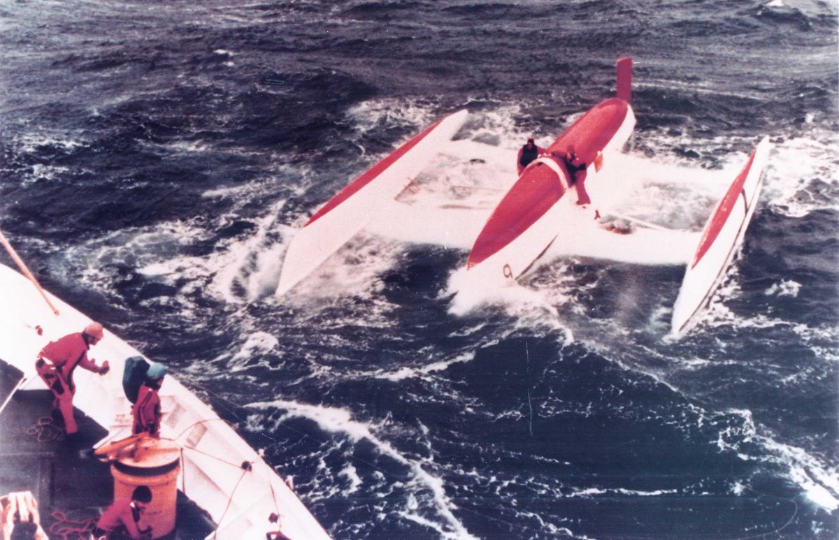
Image courtesy of U.S. Coast Guard
The activated EPIRB distress signal from the trimaran “Gonzo” was the first satellite-aided Marine rescue. It proved that satellites were equally capable of detecting signals from ships in distress at sea. The U.S. Coast Guard was tasked with the rescue.
Although Cospas-Sarsat satellites were primarily designed to function on the much improved 406 MHz digital frequency, a provision had to made for the thousands of 121.5 MHz beacons already in use. For this reason, the satellites were designed to receive 121.5 MHz as well. However, analog 121.5 MHz beacons were a source of chronic false alerts from the outset. So in 2009 Cospas-Sarsat made the decision to discontinue listening for 121.5 MHz signals. Although private aircraft can continue to carry existing 121.5 MHz beacons, recent U.S. government regulations have prohibited the sale of new 121.5 MHz beacons in the United States.
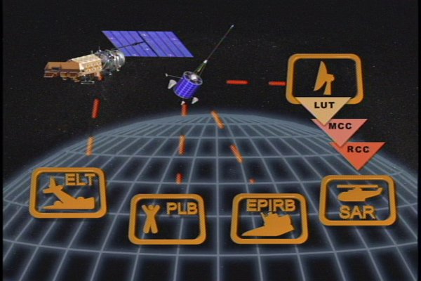
Graphic courtesy of Cospas-Sarsat
The initial flow of the system envisioned over 40 years ago still works today albeit with improved technology and many more satellite constellations listening for distress beacons
The Cospas-Sarsat organization also continued to grow. The four original founding nations have now been joined by 45 other nations, user states and organizations operate ground stations (LUTs) and mission control centers (MCCs) worldwide. MCCs distribute distress alert messages receives by the satellite system to Rescue Coordination Centers (RCCs), Search and Rescue Points of Contact (SPOCs), and other recognized points of contact that can accept responsibility to receive and act upon Cospas-Sarsat distress alert data.
Click image to zoom
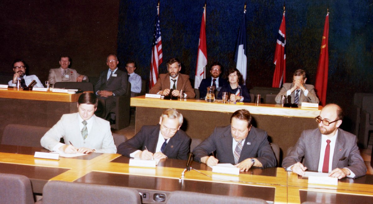
Photo courtesy of Cospas-Sarsat
The four parties signing agreements regarding the Cospas-Sarsat System.
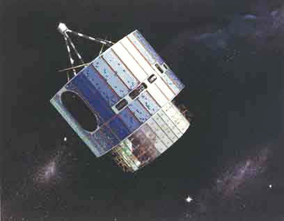
Photo courtesy of NASA
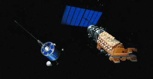
GOES-7 was launched on April 28, 1987. This satellite was the first GOES satellite capable of detecting 406 MHz distress signals from emergency beacons . This was the last of the spin stabilized geosynchronous satellites.
NOAA and all its national partners continue to look for new ways to advance and contribute to the Cospas-Sarsat System of tomorrow.